Reason for test planning was a motion by the municipal council of the city of Zurich. This called for the development of an integral strategic plan for the area around the main station and the adjacent Central. The planning process is intends to define clear specifications for various medium- and long-term projects. Four teams were called to participate the two-stage test planning. Two of them were allowed to deepen their contributions in the second stage. The topics of urban development, urban space, social space, traffic and urban climate were some of the focus subjects. The findings of the test planning will then be synthesized by the municipality itself, translating the two proposals into one master plan.
The documents of the first phase can be accessed here and those of the second phase here as part of an online exhibition.
Mobility hub and urban space
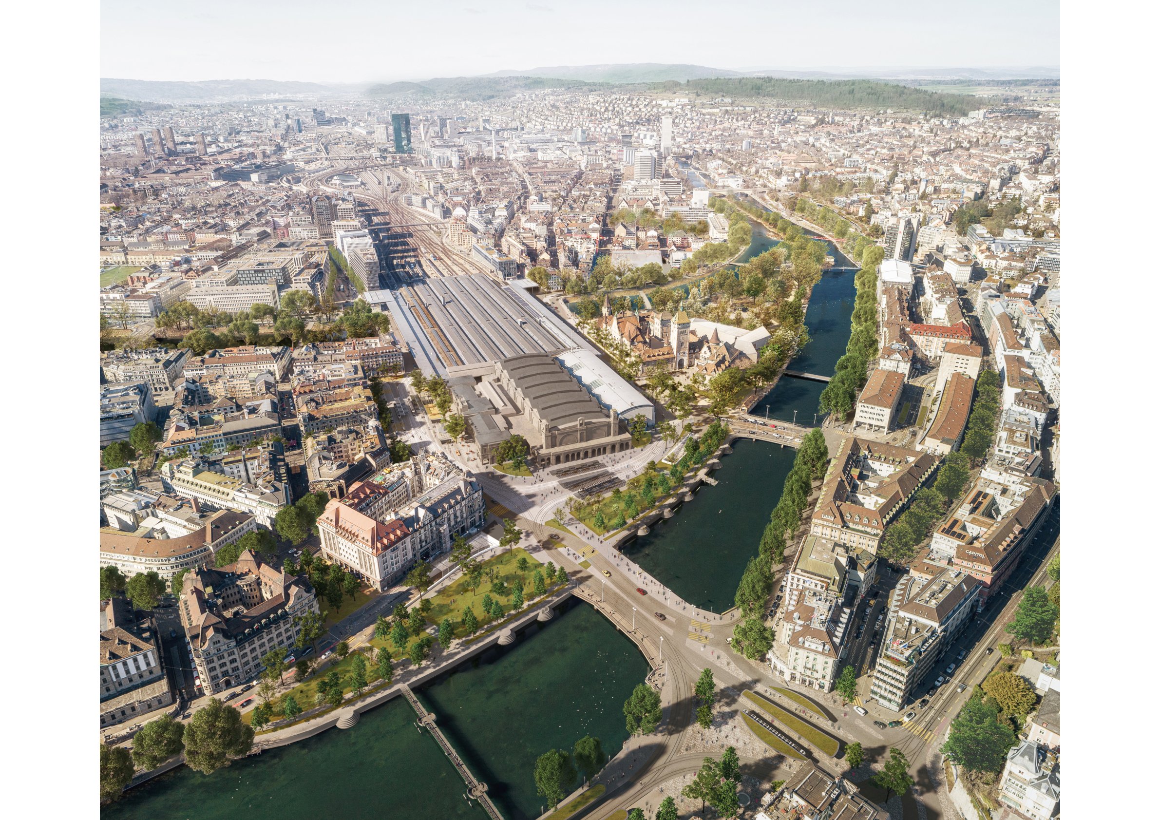
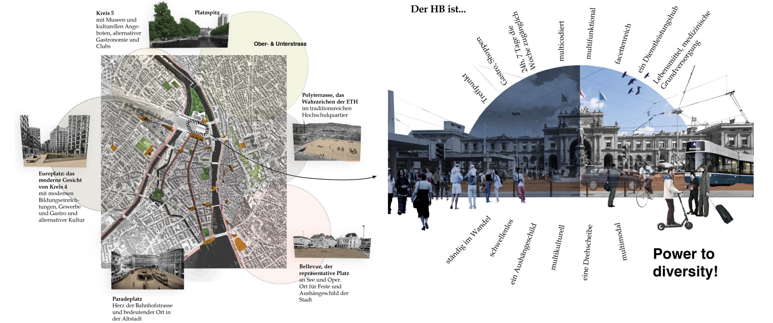
Zurich main station is both a mobility hub and urban space equally. With over 460,000 visitors on weekdays, it serves five times more people than Zurich Airport at its peak. At the same time, it is in the center of the city and its effects radiate out into the adjacent neighborhoods. As a mobility hub, the train station offers various transfer options. It being a space that is open to future developments and therefore adaptable, it does not exclude any modes of transportation. Traffic caused by cars passing through, on the other hand, should be reduced as far as possible. As an urban space, the train station is deeply intwined with the surrounding quarters. It offers a wide range of users access to mobility, services and quality of stay, which is inclusive and can allows approriation. Its unique location between the Limmat and Sihl, right in the city center, should be felt again. People, modes of transport and different scales, users and uses, city and nature come together at the station – coexistence in a small space.
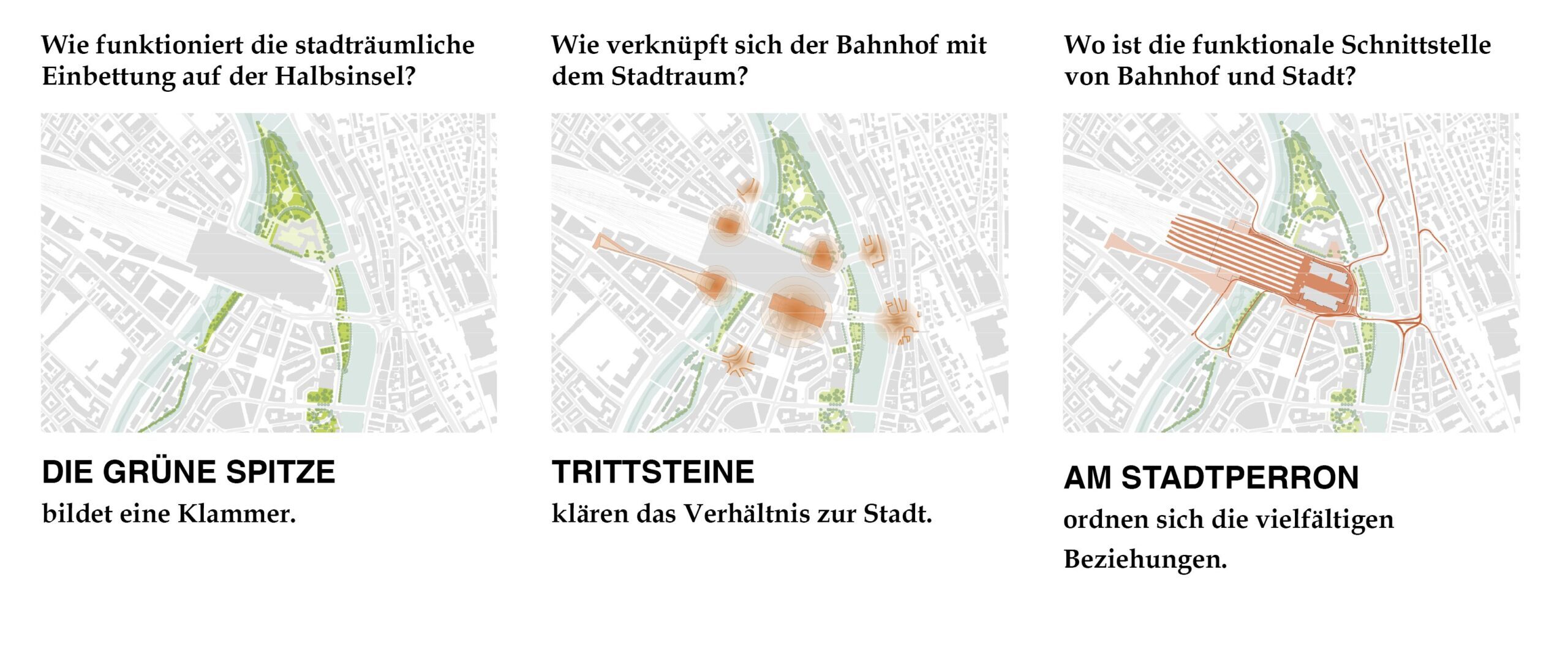
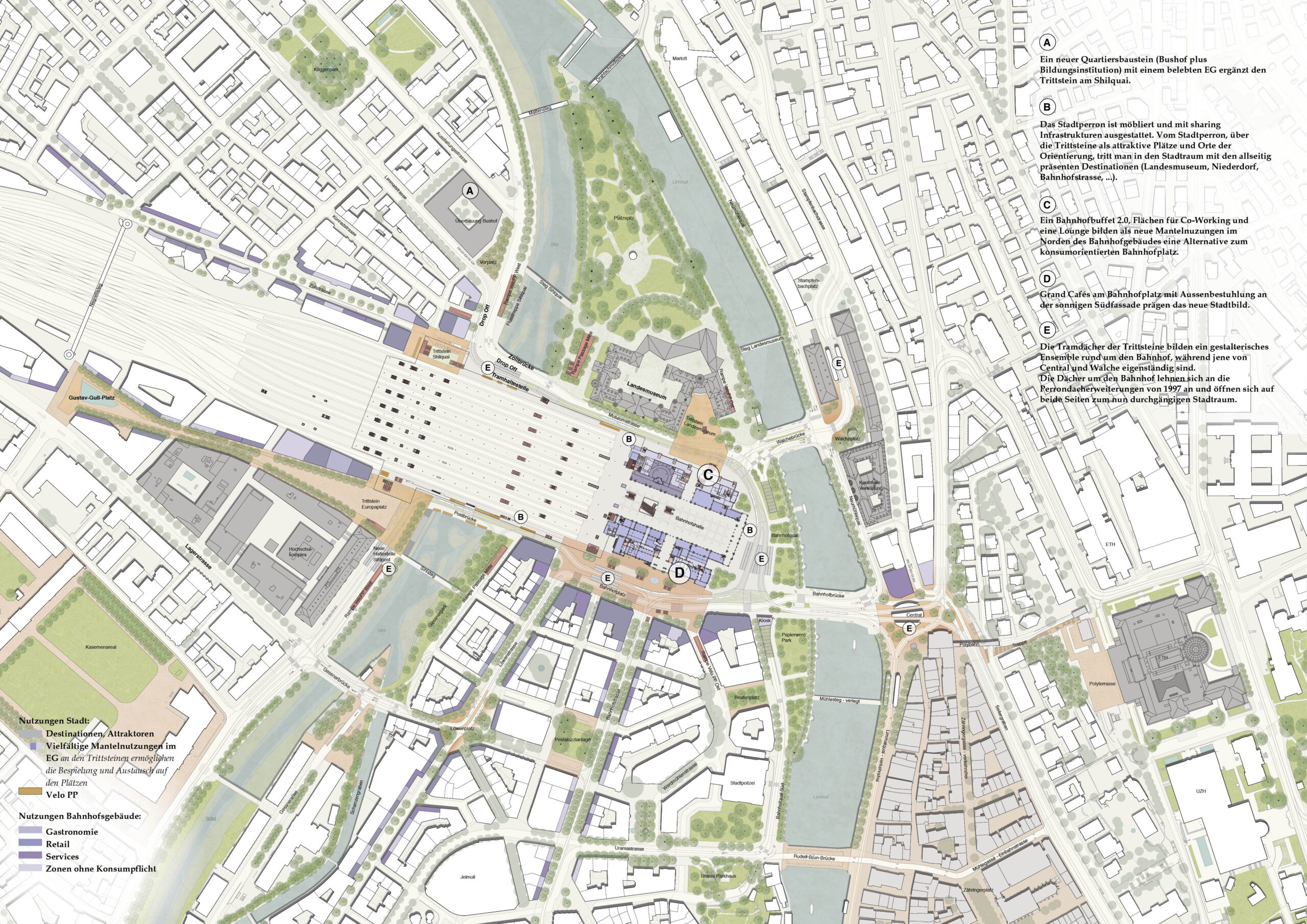
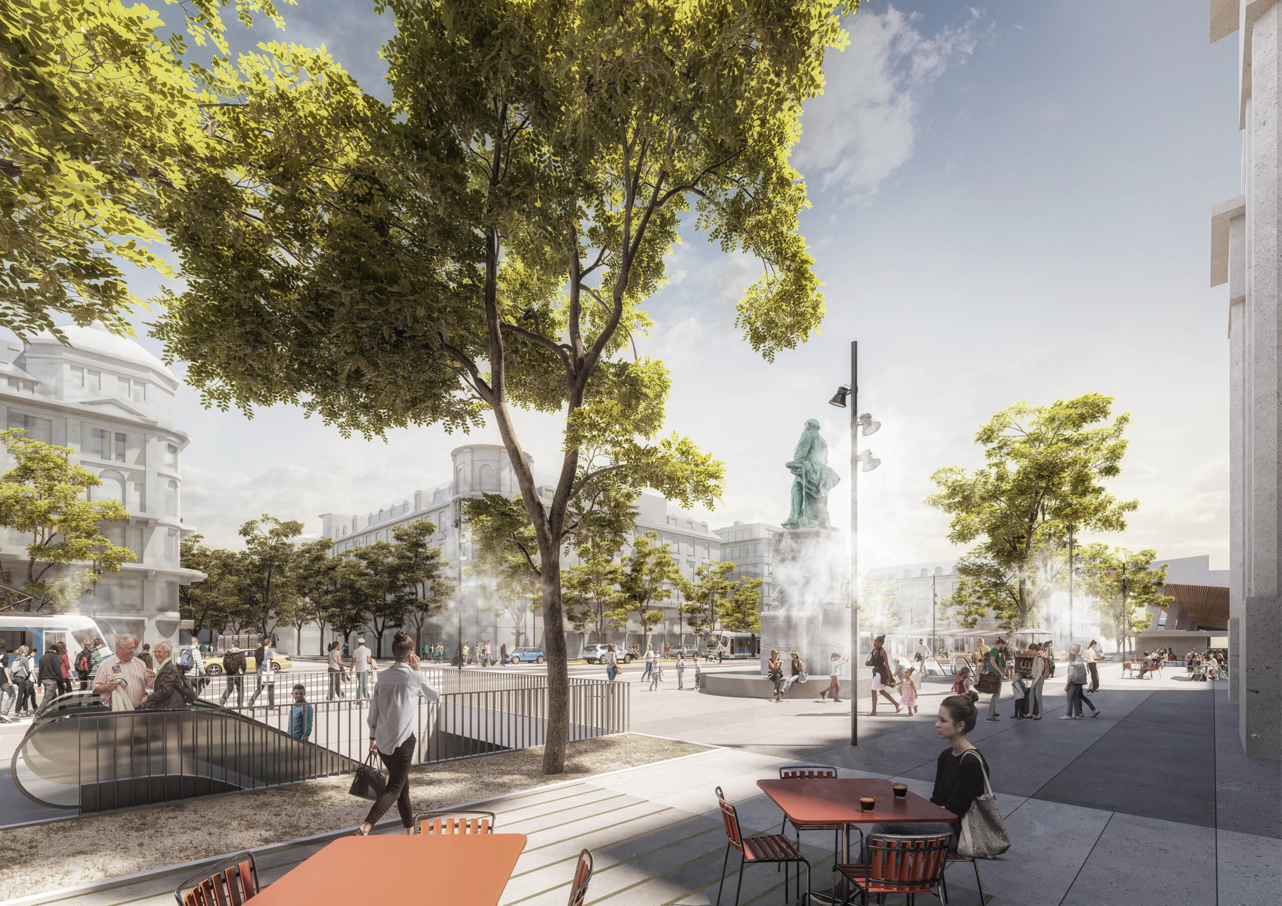
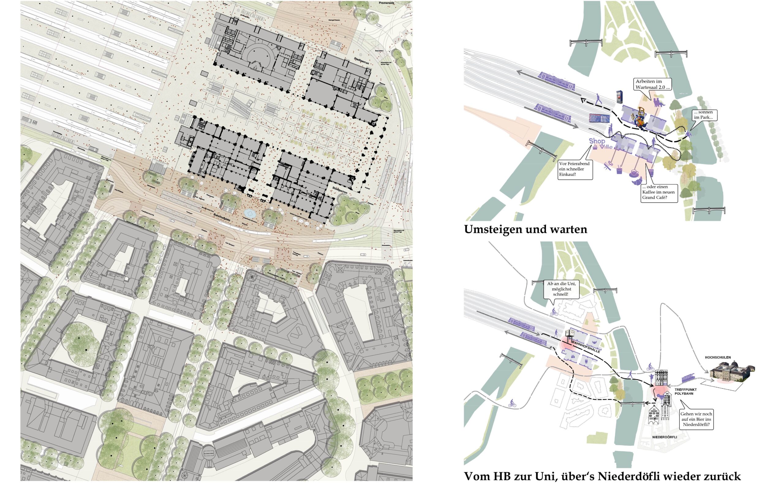
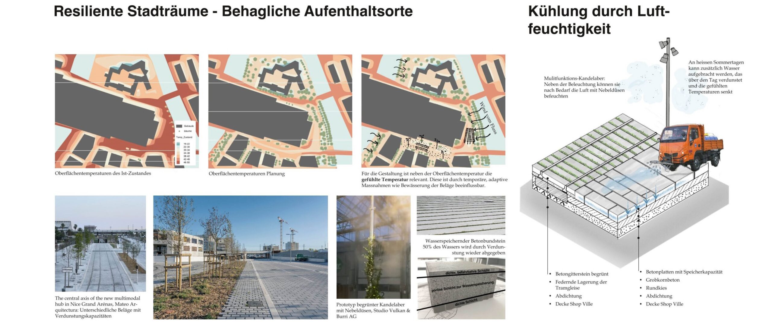
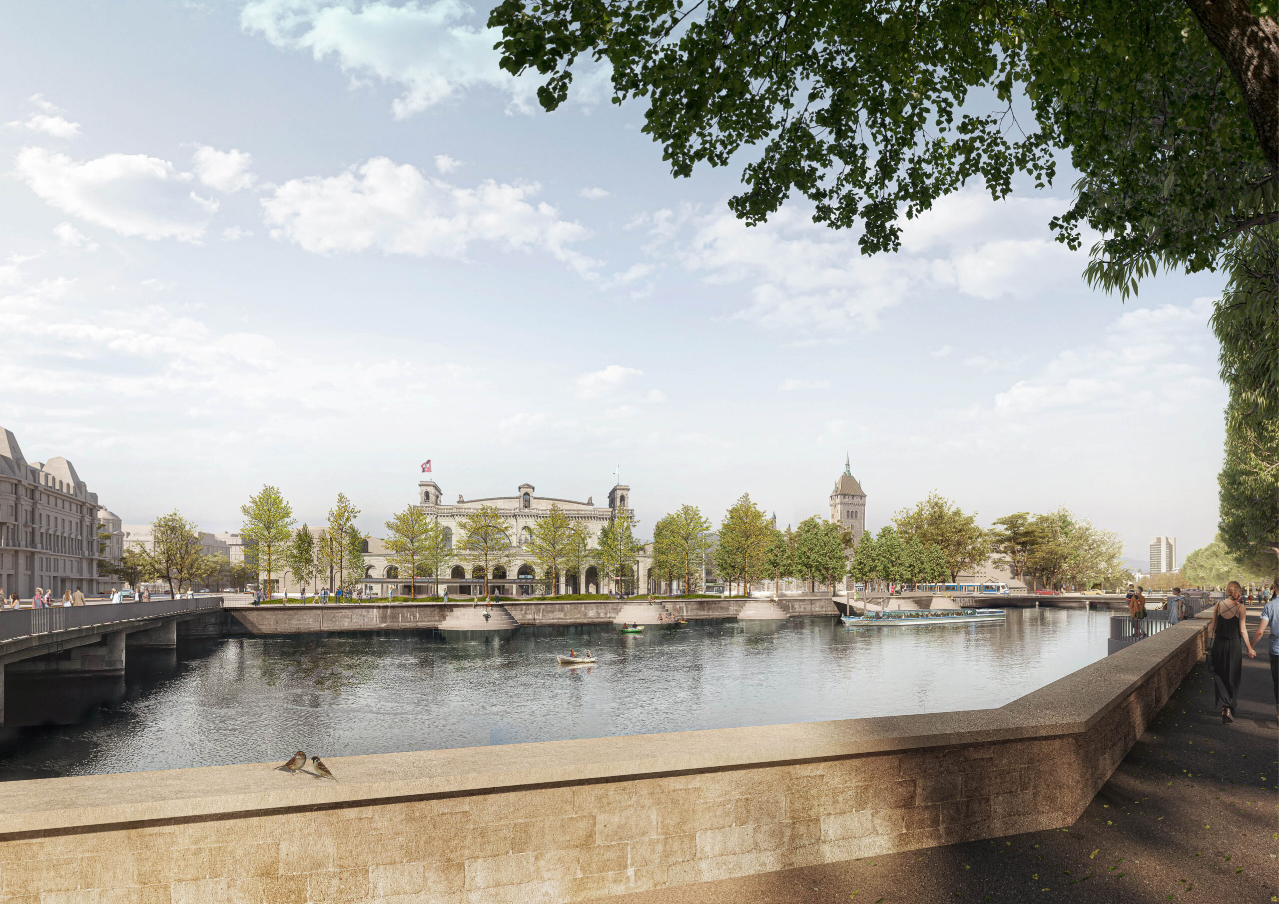
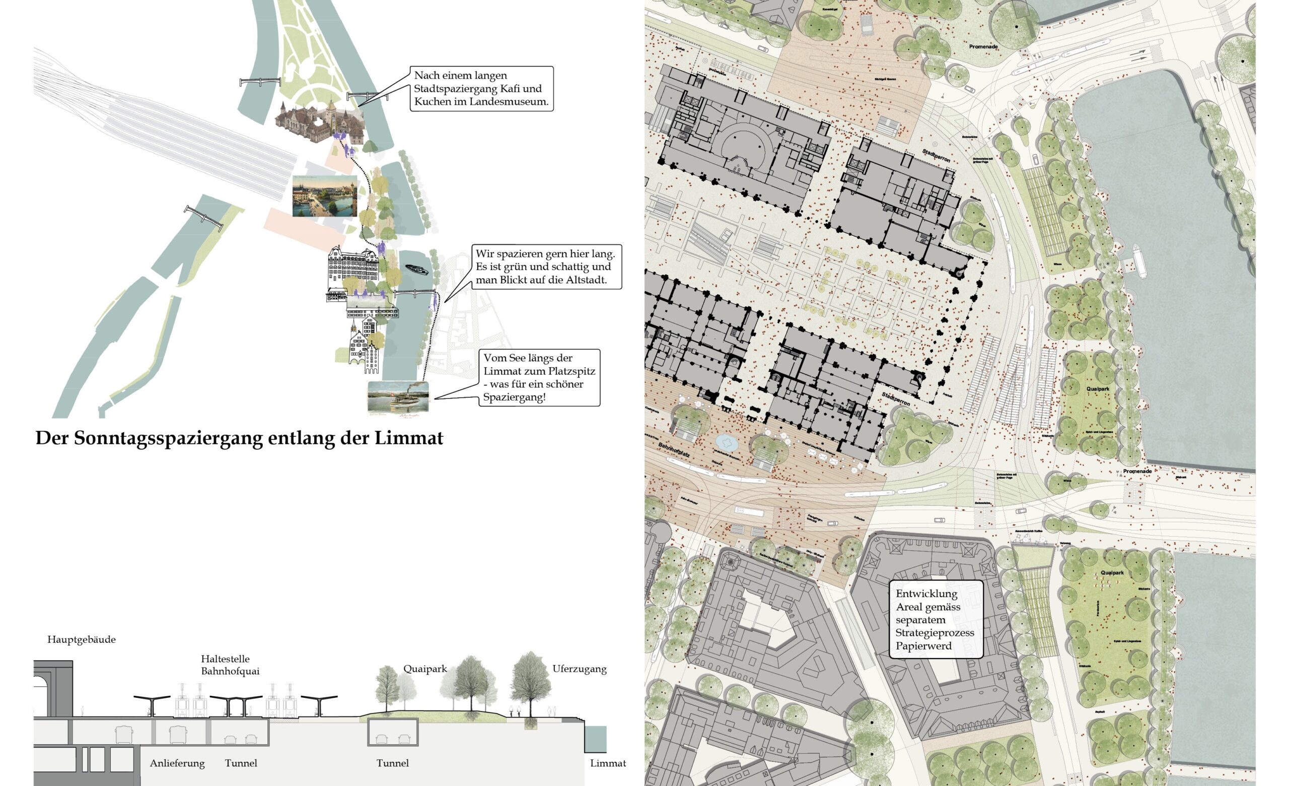
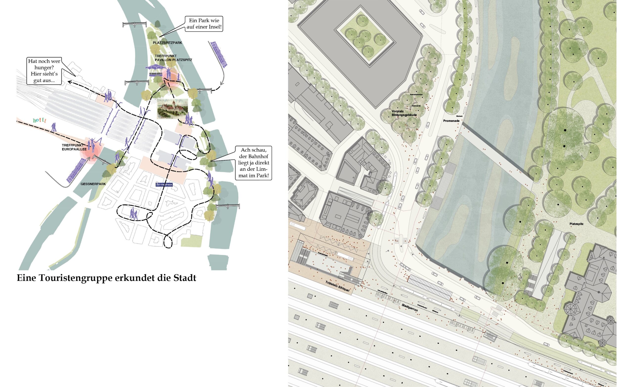
The main idea structures clear urban spaces that form a robust and overarching vision. Around the historic train station, the green arrow forms a cohesive open space with a high quality of stay by the water. Four stepping stones – the Bahnhofplatz, the Europaplatz, the Sihlquai & the square in front of the Landesmuseum mark the heads and allow the transition into the adjacent urban spaces. Finally, the “Stadtperron” – the city platform – functionally interweaves the station with the city. It creates clear orientation around the train station and holds the entrances and exits to the underground Shopville. In addition to public transport stops and Kiss & Ride, sharing-mobility options are also arranged here.
Location: Hauptbahnhof Zürich
Client: Stadt Zürich
Landscape (Lead): Studio Vulkan
Architecture: Hosoya Schaefer Architects
Sociology: Brigit Wehrli-Schindler
Traffic: B&S Ingenieure und Planer & IBV Hüsler
Sustainability: Drees & Sommer
Visualization: Atelier Brunecky
Key Topics & Deepening of subjects
– With the city platform (Stadtperron), four tram stops are directly connected the station without pedestrians having to cross the street
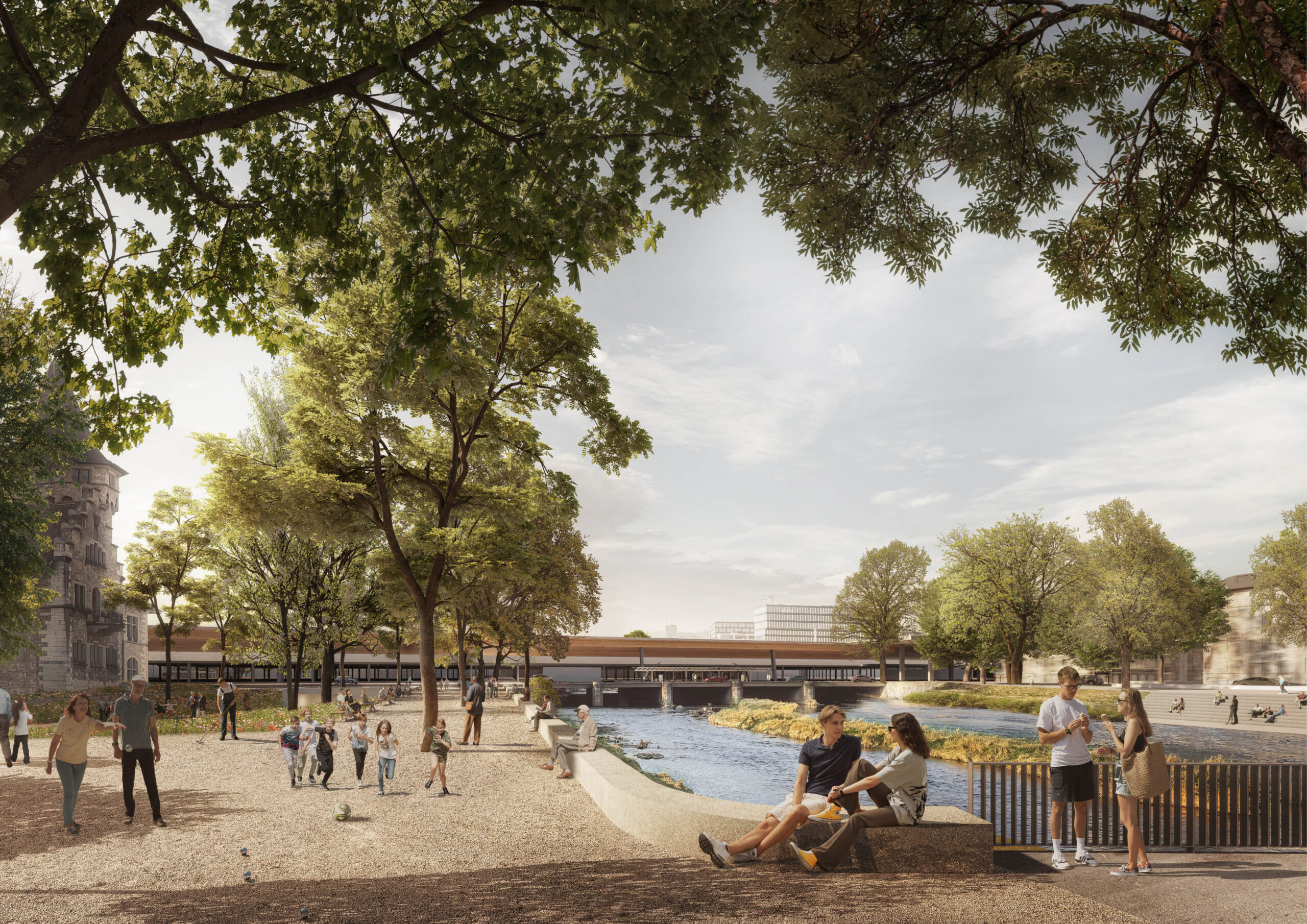
– Car-free access from the station to the Limmat
– Car traffic on Central will be greatly reduced. A distinctive open space to the car-free Limmatquai with good permeability is being created for pedestrians and cyclists.
– The junctions Bahnhofquai/Bahnhofbrücke and Bahnhofquai/Uraniastrasse will be greatly simplified
– The Rudolf Brun Bridge becomes a shared space with only one lane (today there are three)
– Mühlegasse turns into a shared space, both parts of Niederdorfstrasse grow together again
– The Zollstrasse will be car-free
– On the Bahnhohplatz, the street space will be reduced from six to two lanes and there will be continuous bicycle connections
– The new Europaplatz stop creates attractive, crossing-free access to the train station from the west of Zurich and opens up the Europaallee district.
– The reduction in traffic space upgrades Löwenstrasse and creates large-scale crossing options
– The lower Gessnerallee becomes a car-free recreation area on the Sihl